
Drone inspection services, flown by a pilot.
Roofs, towers, bridges, solar farms, power lines and pipelines, inspected from the air by an FAA Part 107 certified remote pilot.
- FAA Part 107
- Thermal and LiDAR
- Travels for jobs
A closer look, without the climb.
Drone inspection services from Nazarov Aviation put a camera where a ladder, a lift or a climb would otherwise have to go. You see the problem up close, and nobody has to stand on a roof or a tower to find it.
The flying is done by Vlad, who holds an FAA Part 107 remote pilot certificate on top of the Commercial certificate he flies airplanes on. We are based in Seattle at KBFI (Boeing Field), and we travel for jobs.
Ten things we inspect from the air.
Roofs
Shingles, flashing, gutters and storm damage, photographed without anyone walking the roof.
Cell towers
Antennas, mounts and hardware up the full height of the tower, seen from the air instead of from a climb.
Bridges
Decks, piers and spans, documented from angles that are hard to reach from the ground.
Solar farms
Panel rows covered from above, with a thermal camera to show cells running hot.
Power lines
Lines, poles and hardware along a route, documented from a safe distance.
Pipelines
Long stretches of right-of-way covered from above instead of on foot.
Wind turbines
Blades, nacelles and towers looked at closely without sending anyone up.
Structures
Walls, chimneys, stacks and the parts of a building nobody can see from the street.
Construction progress
Repeat flights over a site, so you can see how the work is moving between visits.
Environmental assessment
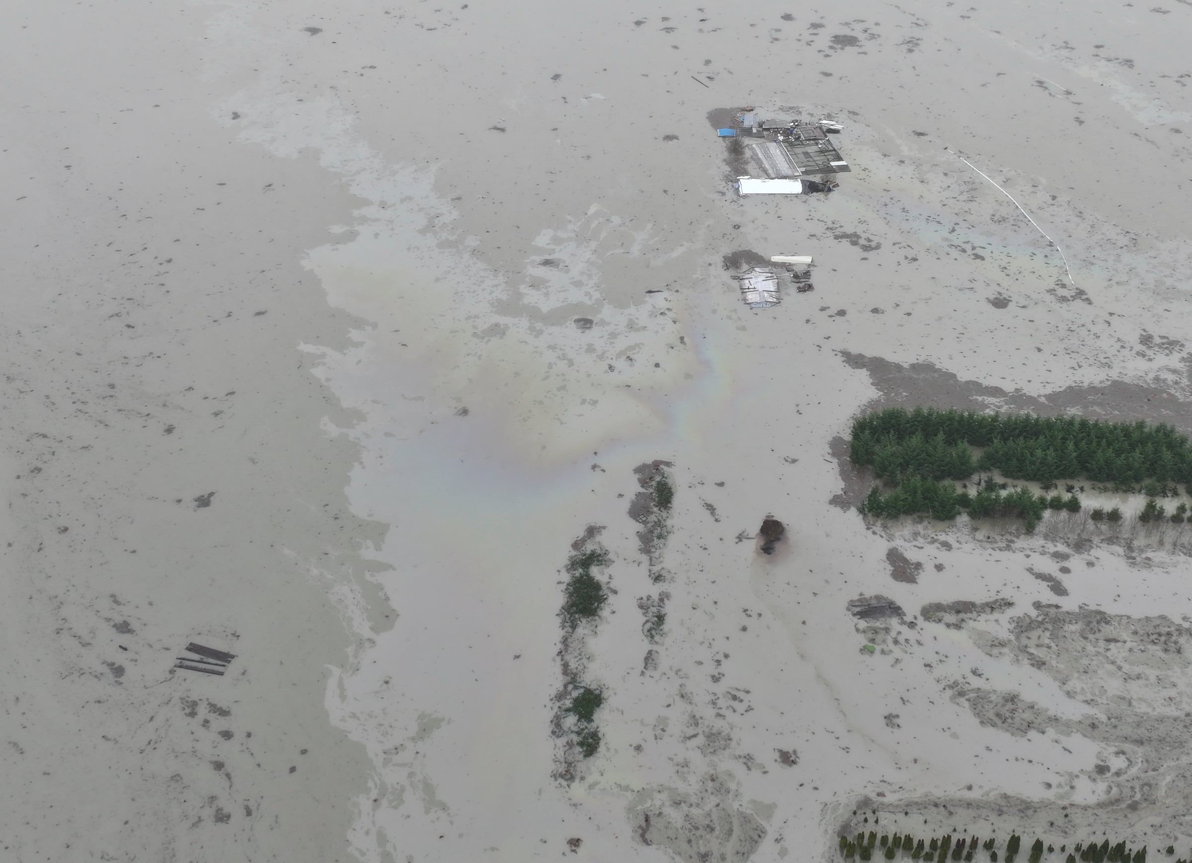
Spills, flooding and site conditions, assessed from the air. We have flown a pipeline leak, reading the oil sheen on floodwater from above.
See the whole spill from above.
The rainbow color on the water is oil. From the ground you only see the edge of it. From the air you can see where the oil is and how far it has spread, in one clear photo you can send to whoever has to deal with it.
Ask about a spill or flood inspectionPlanned like a flight, because it is one.
Tell us what and where
The structure, the address or the stretch of line, and what you are worried about.
We plan the flight
Airspace, weather and access are checked before we go. Planning a flight is what a working pilot does every day.
We fly it and send you what we found
You get the photos and video from the flight, and a straight answer about what they show.
The right camera for the job.
Most jobs fly on a Mavic 3 Pro, for detailed photos and video.
When a job needs more than a picture, we bring in a thermal or LiDAR drone:
- Thermal shows heat a normal camera cannot see, like moisture under a roof or a solar cell running hot.
- LiDAR measures a site or structure and builds an accurate 3D model of it.
Have something that needs a look?
Tell us what it is and where. You will hear back about timing and what the flight needs.
Tell us what needs a look.
The structure and the address are enough to start.